 Microgravity surveying involves the measurement of the Earth’s Gravitational Field on the earth’s surface. Density variations of the underlying geology will result in variations of the recorded microgravity readings. These density variations may be caused by features such as air, water or sediment filled cavities, or changes in the nature of the subsurface material and bedrock or in the bedrock topography.
PRINCIPLES
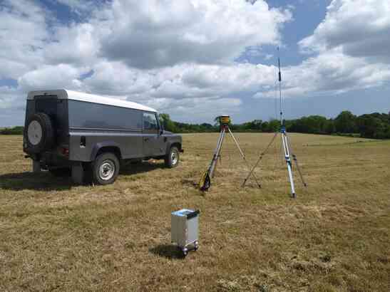
The strength of the Earths Gravitational field is given as 980 Gal or approximately 9.81 m/s2. Microgravity measures minute changes in the gravitational field at the Earths surface. Variations as small as 5 – 10µGal (approximately 1 x 10,-8 of the Earths Gravitational Field) are detected and resolved as significant target features. However the slightest change in elevation and/or lateral position can give rise to larger variations and as such the positional accuracy of the measured data is paramount. This accuracy is achieved by the use of total station or RTK dgps systems.
RESULTS
Corrections are applied to the recorded data to eliminate effects of local and regional factors including; topography, elevation, tidal effects, latitude and density of the underlying material, all of which have varying influences on the measured microgravity value. When these factors have been corrected the resulting Bouguer gravity values are displayed as line graphs or contour plots. Anomalous decreases in the Bouguer gravity values may indicate the presence of cavities in the subsurface. They may also indicate variations in overburden and/or weathered rock thickness. In theory the microgravity method is capable of detecting an air filled cavity with a 2m radius at a depth of 10m below ground. Simple data modeling can be carried out to determine the source of the anomalies.
MICROGRAVITY
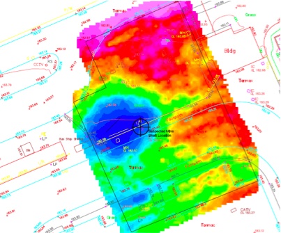
The survey results above show the location of a capped mine shaft below an industrial development site. The blue area represents a gravity low due to the lack of mass caused by the voided shaft.
Microgravity is highly effective at resolving the presence of voids and can be used in many situations where other geophysical techniques would not be effective.